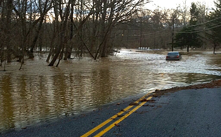
NWS Issues Flash Flood Watch Until Tuesday Evening
Monday night’s showers have prompted the National Weather Service to issue a round of Flash Flood Watches that will be effective until Tuesday evening.
According to the NWS, a Flash Flood Watch means the threat of flash flooding exists or poor drainage areas, and along rivers and creeks.
Showers and thunderstorms will continue to move across portions of the region, so commuters should expect rainfall amounts between a tenth and quarter of an inch with gusty winds to accompany the showers and thunderstorms.
Officials warn residents to use caution while driving, monitor later forecasts, and be prepared to take action should Flash Flood Warnings be issued.
9:35PM MON – Flood Warnings remain in effect for locations in bright green. Flash Flood Watches & River Flood Watches remain in effect for areas in dark green. Showers & thunderstorms will continue to move from SW to NE across portions of the region. Turn around, don’t drown. pic.twitter.com/tFFJQUXiPF
— NWS DC/Baltimore (@NWS_BaltWash) September 18, 2018
Another round of showers and thunderstorms will move across the area this afternoon. We have issued Flash Flood Watches for the areas in green through 6 PM this evening. The Flash Flood Watch for Augusta County is due to high water at the Robinson Hollow and Tom’s Branch Dams. pic.twitter.com/HRGKRWIjrk
— NWS DC/Baltimore (@NWS_BaltWash) September 18, 2018

Engage us on Facebook
Follow us on Twitter
Tweets by @mymcmedia