Tornado Warning & Severe Thunderstorm Warning
June 13 @ 6:00 p.m.
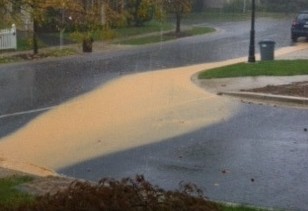
After the severe storm passed through, the National Weather Service issued a Flood Warning for Montgomery County.
Residents should not try to cross flooded roads. Flooded areas may be harder to identify at night so use caution while driving.
Update June 13 @ 3:53 p.m.
The National Weather Service issued a tornado warning for eastern Montgomery County in effect until 4:30 p.m.
Take cover now. Move to an interior room. Motorists should not take shelter under highway overpasses.
_________________________________________________________________
Update June 13 @ 3:41 p.m.
The National Weather Service issued a tornado warning for central Montgomery County in effect until 4:15 p.m.
Locations impacted include Rockville, Aspen Hill, Olney, Colesville, and Fairland.
Take cover now. Move to an interior room. Motorists should not take shelter under highway overpasses.
_________________________________________________________________
Update June 13 @ 3:23 p.m.
The National Weather Service issued a severe thunderstorm warning for Montgomery County in effect until 4:30 p.m.
Locations impacted include Rockville, Germantown, Montgomery Village, North Potomac, and Gaithersburg.
_________________________________________________________________
Update June 13 @ 3:22 p.m.
The National Weather Service issued a tornado warning for western Montgomery County in effect until 4 p.m.
Take cover now. Move to an interior room on the lowest floor of a sturdy building. Avoid windows. Motorists should not take shelter under highway overpasses.
_________________________________________________________________
Update June 13 @ 2:49 p.m.
The National Weather Service issued a severe thunderstorm watch in effect until 3:45 p.m. today for western Montgomery County.
A severe thunderstorm was detected 8 miles northeast of Front Royal, moving east. This storm is capable of producing damaging winds in excess of 60 mph.
_________________________________________________________________
Update June 13 12:26 p.m.
The National Weather Service issued a severe thunderstorm watch in effect until 7 p.m. tonight.
The primary threat with these storms includes extremely heavy rain, large hail, lightning, and isolated tornadoes. Those with outdoor plans should monitor the skies and be prepared for threatening weather.
A Severe Thunderstorm Watch means conditions are favorable for severe storms in and close to the watch area. Severe thunderstorms can and occasionally do produce tornadoes with little or no advanced warning. Residents should be on the lookout for threatening weather conditions and listen for later statements and possible warnings.
_________________________________________________________________
Update June 13 The National Weather Service issued a flash flood watch in effect until 8 p.m.
Update June 13 The National Weather Service issued a severe thunderstorm watch for Montgomery County early this morning. The watch is in effect until 11 a.m. Expect extremely heavy rain, large hail, lightning, and isolated tornadoes.

The National Weather Service today (June 12) issued a flash flood watch for Montgomery County from midnight through Thursday evening. According to the national weather service, showers and thunderstorms are expected across the county tonight and may produce heavy downpours. Flash flooding of streams and low lying areas is possible.
Another round of storms may bring heavy rain on Thursday, June 13. Severe weather watches and warnings, including tornado, severe thunderstorm and flood, are likely over the next 48 hours. Prolonged power outages may be possible.
Flash Floods kill more people every year than any other weather hazard. Do not drive through flooded areas. As little as two feet of water can sweep a vehicle off the road.
Roads in Montgomery County Subject to Periodic Flooding:
Down County Areas:
MD 29 (Columbia Pike) at Paint Branch – N. of White Oak
MD 185 (Conn. Ave) at Rock Creek – S. of Kensington
MD 190 (River Road) at Cabin John Creek – Potomac
MD 193 (Univ. Blvd) at Sligo Creek – Wheaton
MD 586 (Viers Mill Rd) at Rock Creek – S. of Twinbrook Pkwy.
Beach Drive in Rock Creek Park – Kensington-Chevy Chase
Sligo Creek Pkwy – Silver Spring-Takoma Park
Up-County Areas:
MD 97 (Georgia Ave) at Reddy Branch – N. of Brookeville
MD 124 (Woodfield Rd) at Goshen Branch and at Gr. Seneca Creek – N. of Brink Rd.
MD 117 (Clopper Rd) at Gr. Seneca Creek – W. of Gaithersburg
MD 117 (Clopper Rd) at Little Seneca Creek – E. of Boyds
MD 355 (Frederick Rd) at Little Seneca Creek – W. of Brink
MD 121 (Clarksburg Rd) near Little Seneca Lake – N. of Boyds
MD 118 (Germantown Rd) at Great Seneca Creek – S. of Germantown
River Rd and Berryville Rd at Seneca Creek – Seneca
Blunt Road at Great Seneca Creek – S. of Brink Rd.
Davis Mill Rd at Great Seneca Creek – N. of Gaithersburg
Brighton Dam Rd at Hawlings River – NE of Brookeville
Goldmine Rd at Hawlings River – E of Olney
Zion Rd at Hawlings River – E. of Laytonsville
Hoyles Mill Rd at ford of Little Seneca Creek – Germantown, west of soccer complex
Loghouse Rd at Magruder Branch – S. of Damascus
Elton Farm Rd at Haights Branch – N. of Sunshine
Howard Chapel Rd at Haights Branch – N. of Sunshine
White’s Ferry Road and River Road – White’s Ferry
Safety Tips:
Here are some safety tips provided by Montgomery County Fire and Rescue Service for motorists who may be driving in heavy rains:
-Know your location when you are driving. If you needed rescue, would you be able to direct emergency crews to your location? Distracted driving can lead to a situation where you are stranded and unable to direct emergency crews to you. Be alert!
-Never drive through a flooded road or bridge. Turn Around – Don’t Drown and try an alternate route! In many cases, it takes far less than a foot of water to incapacitate a vehicle. It may stall, leaving you stranded, and depending on the level of water, you may not be able to open a vehicle door. Do not underestimate the power of moving water.
-Watch for flooding at bridges and dips in the road. Never drive where water is over bridges or roads. Turn around – Don’t Drown! The bridges or the road could suddenly be washed out. If you’re driving at night be especially careful. Often visibility is limited due to wind and rain.
-Often what you can’t see below the surface of the water is far more dangerous than the high levels of that water. Remember that rocks, tree limbs and other debris can be caught in moving water and can be dangerous if you are forced to walk, wade or swim through flood waters.
-If you have to walk or wade through flood water, use a stick to poke the ground in front of you with each step. It can help you determine water levels, the bottom surface and the safest possible way to get to higher ground.
-Six inches of water will reach the bottom of most passenger cars causing loss of control and possible stalling. A foot of water will float many vehicles. Two feet of rushing water can carry away most vehicles including sport utility vehicles (SUV’s) and pick-ups

Engage us on Facebook
Follow us on Twitter
Tweets by @mymcmedia